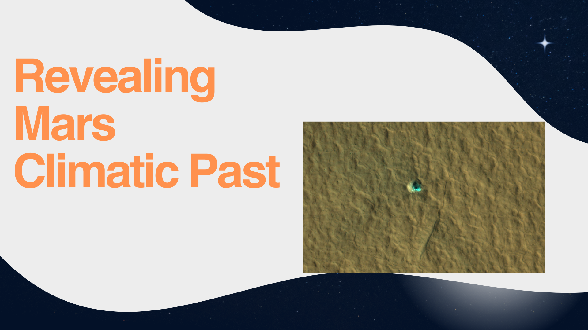
Researchers employ the High-Resolution Imaging Science Experiment (HiRISE) to investigate recent impact craters potentially resulting from meteoroids that could have unearthed ice deposits.

The Subsurface Water Ice Mapping (SWIM) project by NASA has unveiled its fourth series of maps, offering the most intricate depiction of the subsurface ice on Mars to date since its commencement in 2017.
These maps are of utmost importance for upcoming Mars missions, as they pinpoint the prime areas to discover Martian ice accessible from the surface. This ice is essential for astronauts, serving as a valuable resource for drinking water and a crucial component in the production of rocket fuel.
The SWIM project, spearheaded by the Planetary Science Institute in Tucson, Arizona, and overseen by NASA’s Jet Propulsion Laboratory in Southern California, amalgamates data from various NASA missions, including the Mars Reconnaissance Orbiter (MRO), 2001 Mars Odyssey, and the now non-operational Mars Global Surveyor.
The instruments aboard these spacecraft have identified what seem to be accumulations of frozen water beneath the surface of Mars in its mid-latitudes.
Sydney Do, the project manager for JPL’s SWIM project, underscored the significance of selecting landing sites near the equator due to the thicker atmosphere, which facilitates a smoother deceleration of descending spacecraft. Additionally, these equatorial regions provide the warmest temperatures for astronauts in frigid environments, reducing the energy needed to maintain their warmth and equipment.
The most recent SWIM map was generated using two high-resolution cameras aboard the Mars Reconnaissance Orbiter (MRO), offering a more intricate view of the ice’s boundary as close to the equator as possible. Scientists utilize the High-Resolution Imaging Science Experiment (HiRISE) to investigate recent impact craters caused by meteoroids that may have exposed ice deposits.
Gareth Morgan, SWIM’s co-lead at the Planetary Science Institute, emphasized the importance of these impact sites in revealing the presence of subsurface ice, stating, “They provide us with clear evidence of ground ice presence.” The updated map also includes observations of “polygon terrain,” where seasonal expansion and contraction of subsurface ice results in the formation of polygonal cracks, indicating the existence of more hidden ice beneath the surface.
The SWIM project is anticipated to lay the groundwork for a proposed Mars Ice Mapper mission, an orbiter equipped with specialized radar technology designed to search for near-surface ice in regions beyond those where HiRISE has confirmed its presence.
For more Articles:
What is Tomato Flu? – Know More (kmore.info)
What is Dipole Moment? – Know More (kmore.info)